Scientists Reveal How Long We Might Have Before Florida's Coastline Is Underwater
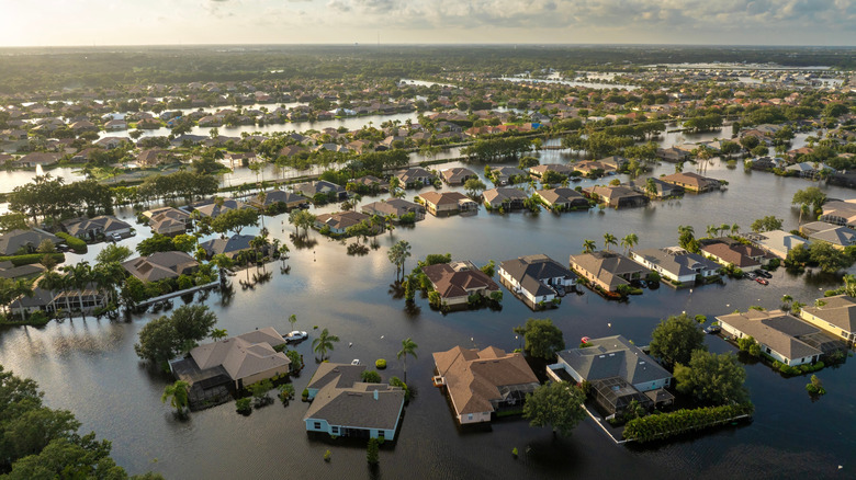
We've known that massive cities are sinking into the ocean for some time, and Florida is poised to lose large portions of Miami in less than 40 years. But the situation is even more dire than that according to an interactive map tool which shows that large swathes of the Florida coastline could be submerged by 2150 and possibly sooner.
Climate Central's sea level rise and coastal flood map, released back in April 2025, uses data from federal agencies, including the National Oceanic and Atmospheric Administration, the U.S. Census Bureau, and the U.S. Army Corps of Engineers, alongside peer-reviewed science published in leading journals to provide a prediction for how the U.S. coastline will change as seas levels continue to rise in the wake of global warming. The states set to be hit hardest are, according to the map, New York, New Jersey, and Florida, with the Sunshine State set to see areas at risk of flooding increase dramatically between 2030 and 2100.
What's more, large parts of the Florida coastline could become submerged within the next hundred years, including the Florida Keys and Everglades National Park, which is the largest wetland ecosystem in the United States and home to several of Florida's endangered species. The map also shows that low-lying areas which sit below flood levels in central Florida could be at risk. Making matters worse, these grim predictions are all based upon countries' current commitments to reducing their emissions by 2050, as per the Paris Agreement.
South Florida will be hit hardest, but the whole coastline is at risk
Climate Central, a nonprofit communications group designed to promote better understanding of flood risk, produced a tool which collates statistics on flood risk for coastal areas and provides a map that shows how at-risk areas will change in the coming decades. The tool allows users to visualize future sea level rise and coastal flood scenarios, providing localized maps, statistics, and graphics to help convey the potential effects sea level rise will have on areas around the world.
Focusing on Florida, the map shows that sea level rise will result in increasingly severe flooding over the next 100 years, with estimates differing slightly depending on the projection source used. Based on the predictions shown on the map, south Florida will take the biggest hit. That area expands significantly when you combine sea level rise with the possibility of a 100-year flood (a term that refers to a flood event that had a 1% probability of happening in a year). Even when looking at the areas at risk of annual flooding, which refers to a flood event that has a greater than 50% chance of occurring, the potential flood areas cover huge portions of the Keys and Florida's southern tip.
Filtering the map by sea level rise and the year 2030 still shows significant areas of southern Florida will be affected as well as hundreds of miles of the state coastline. Miami and Fort Lauderdale won't escape unharmed, with large portions of the coast being put at risk of more severe flooding even by 2030 — though these areas won't be hit quite as hard as the Everglades and Keys. Fort Myers, on the western coast, is particularly at risk, as is the area surrounding the Waccasassa Bay Preserve State Park in the northwest.
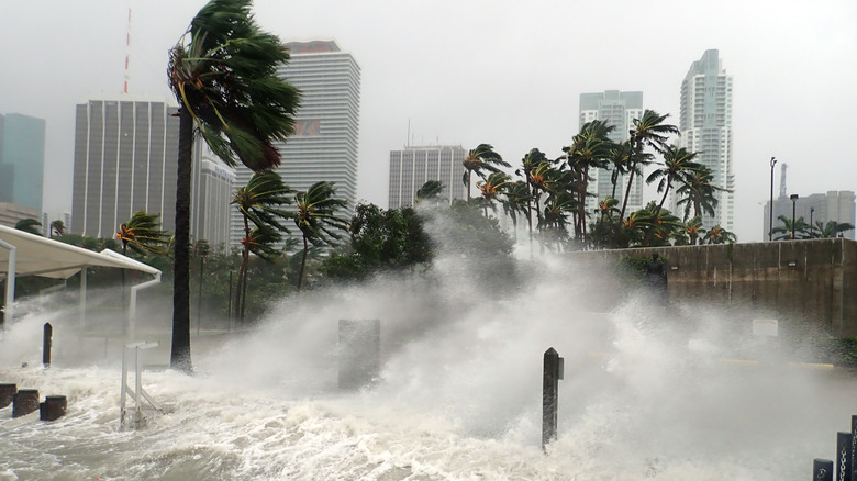
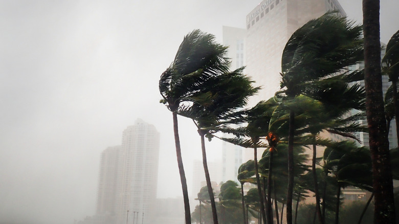
Flooding and rising sea levels will cause untold chaos
A separate table, published alongside the Coastal Risk Finder tool, shows states with the most people and homes located in areas at risk of experiencing a severe coastal flood in 2050. Perhaps unsurprisingly, Florida took the top spot, with 505,000 people and 355,000 homes at risk, and these assessments are based on the assumption that countries fulfill their current commitments to reduce carbon pollution.
Climate Central claims coastal flooding in the U.S. happens three times more often today than it did 30 years ago, and things are only set to get worse. The outlet predicts that by 2050, floods are likely to become 10 times more common than they are today, and this isn't the only place you can find such harrowing statistics. One of the biggest impacts of global warming is sea level rise. As ice sheets in the north and south poles melt as a result of an increase in global temperatures propelled by the burning of fossil fuels, the world's oceans increase in temperature and the sea level rises.
All of this contributes to the future issues facing coastal U.S. cities, and Florida will feel the effects more so than anywhere else. It's important to note that it's not just Climate Central making these dire predictions, either. We know Miami is already sinking into the ocean, and with more than half of Miami-Dade County fewer than 6 feet above sea level, experts are predicting a bleak future for the area. The Southeast Florida Regional Climate Change Compact's Unified Sea Level Rise Projection suggests that by 2040, sea levels could rise between 10 and 17 inches higher than they were in 2000. As such, it really is make or break time for reducing the effects of climate change, particularly if you live on the Florida coast.