Scientists Predict That This Upcoming Ocean Phenomenon Will Be The Worst Of Its Kind This Century
When it comes to the ocean, many phenomena — like fog "tsunamis" and waterspouts — can be seen on the horizon. What can't be seen is how ocean currents affect inland weather. Using buoys and satellites, the National Oceanic and Atmospheric Administration (NOAA) monitors the atmosphere, ocean currents, and temperatures to predict periodic weather patterns. El Niño and La Niña are a couple of examples of this, and forecasters have predicted that a super El Niño is looming and could be the strongest observed yet.
Characterized by sea surface temperatures (SSTs) rising 0.5 degrees Celsius (~1 degree Fahrenheit) above average across the central and eastern Pacific Ocean, an El Niño occurs irregularly and affects weather patterns for months. Super El Niños involve at least a 2-degree (~3.6 degrees Fahrenheit) increase and have a significantly greater impact on global weather. Unfortunately, SSTs have already started rising, and several forecast models estimate that they could exceed 3.5 degrees (~6.3 degrees Fahrenheit) above average by November 2026, making it the strongest ever recorded.
Humans have been observing climate-pattern shifts since at least 1578, when surveyor Francisco de Alcocer recorded the first formal description of an El Niño event in Peru. Since 1950, more than two dozen have been recorded and only a few have been labeled super El Niños. Those occurred in 1982–83, 1997–98, and 2015–16, according to a study published in Nature Communications. While SSTs were around 2.6 degrees (~4.7 degrees Fahrenheit) higher than average during the 2015–16 event, the upcoming phenomenon has the potential to eclipse the strongest super El Niño ever, which occurred in 1877–78, and a study published in Journal of Climate found had a 3.5-degree peak in above-average SSTs.
How the 2026–2027 super El Niño could impact the weather and food
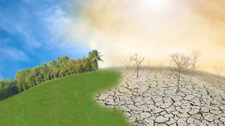
Compared to the weather the United States expected from La Niña in 2025, the opposite is expected with an upcoming super El Niño. One thing that forecasters are certain about is that global temperatures will spike as the warm water stored in the central and eastern Pacific is eventually dispersed into the atmosphere. Since the 2015–16 event set global temperature records, and 2025 was the third-warmest year in history, experts are expecting new highs this year and possibly next.
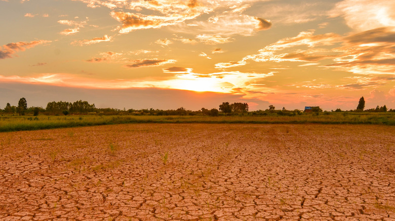
Alongside the heat, some parts of the world — Australia, Indonesia, southern Africa, and northeast South America — will get significantly less rain. An El Niño affects monsoon rain, suppressing precipitation across India, and a strong event could cause a severe drought. Meanwhile, the southern half of the United States and parts of east Africa and central Asia will get much heavier-than-usual rainfall. Such a strong event can spur increased hurricane activity in the eastern and central Pacific while hindering hurricane activity in the Atlantic. However, that's not guaranteed.
These changes in climate could have an impact on the food supply, too. In an interview with Live Science, NOAA's El Niño–Southern Oscillation (ENSO) seasonal forecast team member Nathaniel Johnson explained that a super El Niño may collapse the eastern equatorial Pacific "cold tongue," a nutrient-rich part of the Pacific. That may negatively impact anchovy fisheries and trigger the migration of cold-water species, such as salmon, to colder waters. "We see, potentially, negative impacts on crops where there's drought, so places like from Indonesia to Australia to northern South America tend to have drought. Those are some of the big impacts on food," he noted.